


Mumbai Water Metro: Sailing to Ease Traffic and Revive Island City’s Waterways
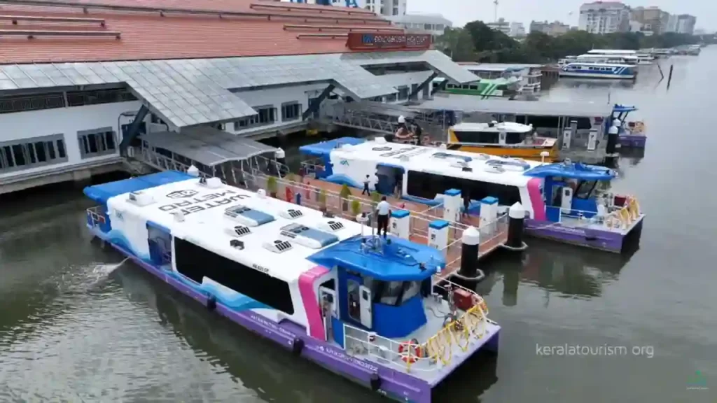
Mumbai, India’s bustling financial hub built on seven islands, faces daily chaos from overcrowded trains, jammed roads, and rising seas of cars. Commuters waste hours in gridlock, while ferries, once a lifeline, faded after failed tries like 1990s hovercrafts and a short-lived Belapur-Gateway run. Enter the Mumbai Water Metro: an ambitious 36-route network across the Mumbai Metropolitan Region (MMR) to ferry up to 18 million passengers yearly. Chief Minister Devendra Fadnavis gave in-principle nod on March 17, 2026, calling it a “coastal transport revolution.” Modelled on Kerala’s hit Kochi system, this Rs 6,592-crore plan taps Mumbai’s 340 km of waterways for scenic, green rides, slashing commute times, boosting tourism, and building shipyards.A Vision to Turn Tides on CongestionMumbai’s locals pack 75 lakh daily; roads choke with 40 lakh vehicles. Water Metro offers breezy escapes: 21 initial routes over 125-340 km (Phase 1: 215 km new + 125 km upgraded), with 25-44 terminals. Daily riders: 44,000; yearly: 18 million, rising to 75 million by 2031. Electric ferries zip between islands, bypassing potholes for sea views of Marine Drive, Bandra-Worli Sea Link.Fadnavis envisions it as the world’s largest water transport network, easing suburban rail pressure (already 1.6 crore water passengers yearly). Ports Minister Nitesh Rane: Start Mumbai city core, expand MMR, linking to Navi Mumbai Airport in 40 minutes from Gateway jetty.Key Routes: From Commutes to CruisesPhase 1 spotlights high-demand hops (6-10 initially):City Core: Nariman Point-Worli-Bandra-Juhu-Versova (coastal buzz).North Links: Versova-Madh, Marve-Manori, Gorai-Borivali (beaches, suburbs).Harbour Hops: Gateway-Mandwa, Belapur-Elephanta (tourist gems).Creek Crossings: Thal-Khanderi, Vasai Creek, Thane Creek, Ulhas River.Airport Express: Gateway to Navi Mumbai International Airport.Outer Reaches: Vasai-Kalyan-Kalher-Bandra-Vashi-Nariman Point.Later: Ro-Pax (car ferries), tourism circuits to Vasai Fort, bird sanctuaries, and parks. Fixed schedules like metro: Peak-hour frequency, digital tickets, rail-metro links.Green Fleet and Smart Tech for Smooth Sails207 vessels mix electrics (zero emissions), hydrofoils (fast), hovercrafts, hybrids, handling 3.5m tides. Private ops under PPP: Govt funds Rs 3,436 crore (civils, safety, jetties); privates Rs 3,156 crore (boats). Operations Control Centre at Kalher (Bhiwandi), backup Fountain Junction (Mira-Bhayandar); dedicated boatyard for local builds.Phases roll steadily:Phase 1 (by 2029): Rs 1,500 crore core network.Phase 2 (2030): Expansion.Phase 3 (2036): Full glory.Kochi Metro Rail Ltd’s DPR (submitted early 2026) guides; the consultant will be appointed in 4 months, then clearances, tenders.Kochi Model: Mumbai’s Fare GuideMumbai Water Metro ticket costs are not yet finalized, as the project is in planning (DPR stage, rollout eyed December 2026 onward). Officials aim for affordable fares like Kochi’s model (its blueprint), to beat past flops from high prices. Expect Rs 10-50 per short hop (e.g., 5-10 km), scaling with distance, cheaper than taxis (Rs 200+), on par with buses (Rs 10-30), and scenic vs. trains. Daily passes, monthly options, and UPI/app tickets planned.Kochi Water Metro (Mumbai’s inspiration) sets the benchmark:Single journey: Rs 20 minimum to Rs 40-50 maximum (e.g., Vytilla-High Court: Rs 40; Fort Kochi: Rs 40).Kochi1 Card: Rechargeable smart card (metro+water), 20% discount.Passes:Pass TypeCostValidityWeeklyRs 1807 daysMonthlyRs 60030 daysQuarterlyRs 1,50090 daysPast Flops to Future Wins: Learning from Waves1990s hovercrafts sank on costs; 2024 Belapur-Gateway fizzled on low uptake. This time? Affordable fares (Rs 20-50?), eco-focus, integration fix it. Kochi’s success (78 boats, 5 lakh riders/month) proves demand; Mumbai’s waterways are unused despite island roots.Hurdles and HorizonsEco-clearances, tides, and monsoons challenge, but tidal-proof jetties and weather-resilient boats are ready. By 2036, imagine: Skip Virar trains, sail Versova-Bandra in 20 minutes; tourists yacht Worli sunsets. Mumbai sails again, cleaner, calmer, connected.
Anji Khad Bridge: India’s First Cable-Stayed Railway Marvel Connecting Kashmir to the Nation
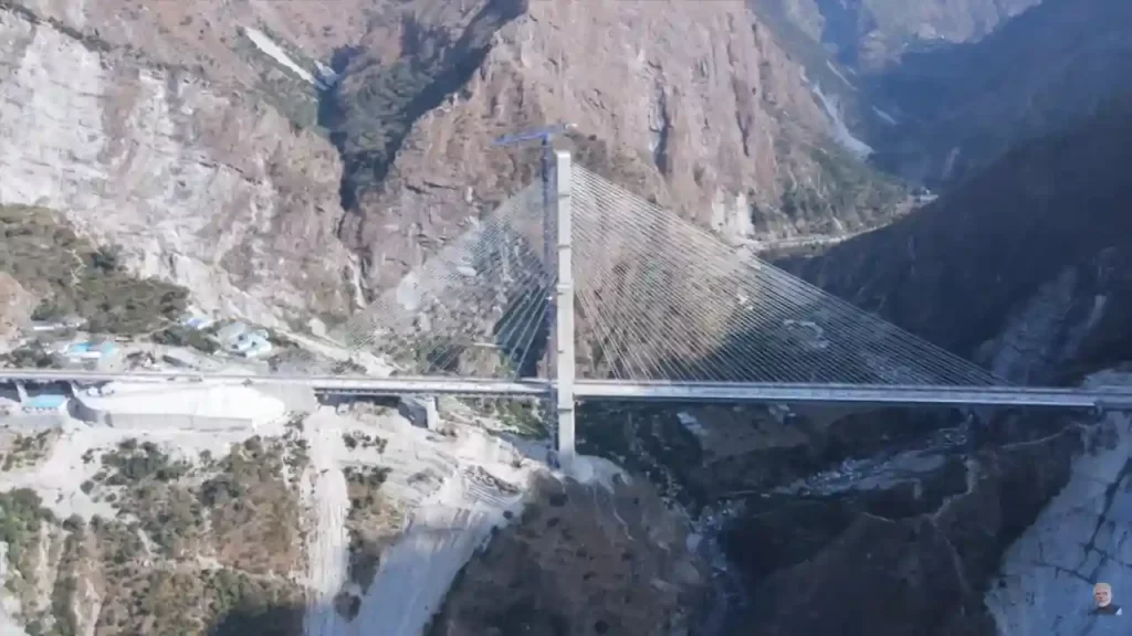
In the rugged hills of Jammu & Kashmir, where steep gorges and fierce winds challenge every builder, a stunning engineering wonder now stands tall. The Anji Khad Bridge is India’s very first cable-stayed railway bridge, a key piece of the massive Udhampur-Srinagar-Baramulla Rail Link (USBRL) project. This 272-kilometer all-weather rail line will finally connect the beautiful Kashmir Valley to the rest of India, ending decades of isolation. Prime Minister Narendra Modi inaugurated it on June 6, 2025, alongside the world’s highest rail bridge over the Chenab River. These bridges mark a historic moment, turning tough Himalayan dreams into reality and opening doors for faster travel, trade, and tourism.Where It Stands and What It ConnectsThe Anji Khad Bridge stretches gracefully across the Anji River, a sparkling tributary of the mighty Chenab, in Reasi district of Jammu & Kashmir. It links the pilgrimage town of Katra (base for the Vaishno Devi temple) to Reasi, about 80 kilometers from Jammu city. This spot sits in the young, shaky folds of the Himalayas – a place with deep gorges, near-vertical walls, earthquakes, and winds gusting up to 213 km/h (almost cyclone strength). Before this bridge, trains had to take long, winding detours. Now, passengers zoom through safely, cutting travel time and costs.Part of the USBRL mega-project, which includes 943 bridges and 36 tunnels, the bridge ensures year-round connectivity. No more snow-blocked roads or floods, trains will run smoothly, carrying people, goods, and hope to Srinagar and beyond.A First in India: Cable-Stayed Design Explained SimplyCable-stayed bridges are like giant clotheslines holding up a road or rail deck. Strong cables stretch from tall pylons (towers) directly to the bridge floor, making them perfect for long spans over deep valleys. Unlike suspension bridges (like Howrah), these are simpler, cheaper, and quicker to build in tough spots.The Anji Khad Bridge shines with these standout features:Total length: 725 meters (about 2,380 feet), with a 473-meter cable-stayed section.Height: 331 meters (1,086 feet) above the riverbed – taller than many skyscrapers.Main pylon: Inverted Y-shape, rising 193-196 meters (633 feet) from foundation – one of the tallest of its kind.Cables: 96 high-tensile cables of different lengths, using 653 kilometers of strands total. They create an asymmetrical design for stability.Deck width: Supports double rail tracks, plus a 12.3-foot service road and 5-foot footpaths on both sides.Train speed: Safe for 100 km/h services like Vande Bharat.Built with 8,200 metric tonnes of steel, it took just 11 months for the main structure. Italian firm Italferr (FS Group) handled design and supervision, their $70 million project won the 2024 ENR Global Best Projects Award for excellence, innovation, and safety.Built for Battle: Surviving the Himalayas’ FuryThe Himalayas don’t play nice. Steep slopes, loose rocks, quakes (Zone V), and howling winds tested every bolt. Engineers used:Seismic-proof tech: Flexible joints absorb shocks.Wind tunnels: Tested for 213 km/h gusts.Sensors everywhere: Integrated health monitoring tracks stress, vibrations, and cracks in real-time.Special concrete: Resists extreme cold (-20°C) and heat.One clever trick? Asymmetrical layout let most work happen from one side, avoiding unstable slopes. Construction used cranes, helicopters for cables, and precision tech, all without harming the fragile ecology.Part of USBRL: Kashmir’s Rail LifelineThe USBRL (started 2002, cost Rs 40,000+ crore) drills through mountains to link Udhampur (on Jammu-Del train line) to Baramulla near Srinagar. Highlights:Chenab Bridge: World’s highest rail arch (359m/1,178 ft), inaugurated same day.Tunnels: 119 km total, including the longest at 12.7 km.Benefits: Srinagar is 3.5 hours from Delhi; apples, saffron to markets fast; jobs, tourism boom.PM Modi flagged Vande Bharat trains from Katra to Srinagar, zipping tourists to Vaishno Devi and Kashmir’s valleys.Global Praise and Real ImpactThe bridge isn’t just Indian pride, it’s world-class. ENR Award beat 120 entries for bridging tough terrain sustainably. Italferr calls it “unprecedented” for India. Locals cheer: Faster pilgrimages, cheaper goods, and army supplies secure.Challenges? Monsoon floods, landslides delayed it years. But grit won, now trains roll where eagles soar.
Amaravati: Andhra Pradesh’s New Capital City Finally Coming to Life After Years of Drama
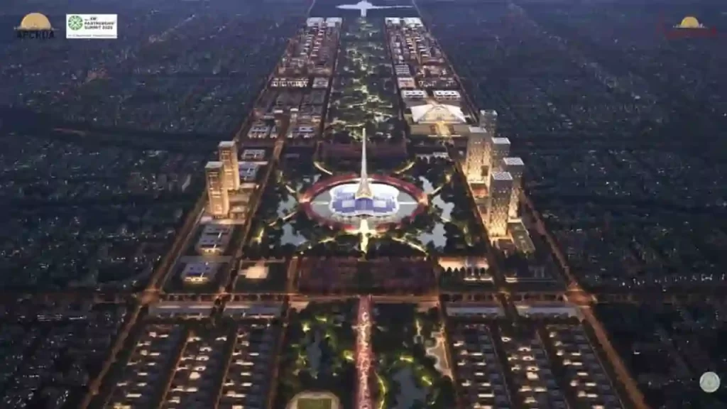
Imagine building a brand-new capital city from scratch – a modern wonder along a mighty river, designed by global experts, powered by green energy, and home to millions. That’s the dream of Amaravati, Andhra Pradesh’s greenfield capital project led by Chief Minister N. Chandrababu Naidu. Once stalled for five long years, this ambitious “people’s capital” or Praja Rajadhani is now buzzing with activity. As of April 2026, projects worth Rs 57,821 crore are underway, with Rs 50,943 crore already grounded. Prime Minister Narendra Modi laid the foundation stone recently, and Naidu promises that Phase 1 will be ready in months. After a decade of twists, turns, protests, and court battles, Amaravati is rising again on the Krishna River banks, ready to be India’s most sustainable city.A Dream Born in 2014: From Bifurcation Blues to Bold VisionAndhra Pradesh lost Hyderabad as its capital after the 2014 bifurcation with Telangana. The state needed a fresh start. Naidu, then Chief Minister, picked Amaravati, a 2,300-year-old site in Guntur district with deep history. Ancient Satavahanas ruled here around 225 BCE, and Emperor Ashoka’s Buddhist stupa (Amaravati Mahachaitya) still whispers of Gautama Buddha’s visits. In the 18th century, zamindar Raja Vasireddy Venkatadri Naidu revived it as a thriving town, building palaces amid fertile Krishna delta lands.Why here? Perfect spot, central, near Vijayawada and Guntur, with great roads, rails, and river views. Naidu announced it on October 22, 2015, with Modi’s foundation stone. The name “Amaravati” means “abode of immortals,” linked to the Amareswara Shiva temple. Singapore’s experts (like Foster + Partners) crafted the masterplan: 217 square km of nine themed sub-cities, Government, Justice, Knowledge, Finance, Health, Sports, Culture, Tourism, and Electronics. At the heart? A green spine like New York’s Central Park, with the Assembly as a 250-meter lily-shaped tower.The Land Pooling Magic: Farmers as True PartnersNo forced takeovers, that’s Naidu’s genius Land Pooling Scheme (LPS) from 2015. Over 27,000 farmers voluntarily gave 33,000 acres. In return:Wet land owners: 1,000 sq yd residential + 450 sq yd commercial plots per acre, plus Rs 50,000/year annuity (rising 10% yearly for 10 years).Dry land owners: 250 sq yd commercial plots per acre + Rs 30,000/year annuity.Landless farmers: Rs 2,500/month pension for 10 years.The Andhra Pradesh Capital Region Development Authority (APCRDA) manages it. Bhoomi puja happened in June 2015; the secretariat and assembly moved to temporary sites by 2017. The Big Halt: Politics, Protests, and a Three-Capitals Twist (2019-2024)Joy turned to pain in 2019. YSR Congress’s Jagan Mohan Reddy won, suspended annuities for 2,903 farmers, canceled pensions for 4,422 families, and ditched LPS for 33,000 acres. He pushed a “three capitals” plan: Amaravati (legislative), Visakhapatnam (executive), Kurnool (judicial). World Bank and AIIB pulled $1 billion in funding. Farmers protested 1,630 days straight, facing lathi charges. The High Court ruled in 2022: Amaravati stays the sole capital. Reddy withdrew the bill in 2021 amid legal heat.The five-year freeze? Cost overruns of 40-45%, roads up 25-28%, buildings 35-55%. The original Rs 51,000 crore budget swelled to Rs 64,910 crore. Infrastructure rusted; investors fled.Revival Under Naidu 2.0: Money Flows, Work Speeds Up (2024-Now)Naidu’s TDP won big in June 2024. He restarted annuities, pensions, and bank loans for plots. Farmers invited to events, Naidu calls them “heroes.” Parliament passed the Andhra Pradesh Reorganisation (Amendment) Bill 2026 on April 1, making Amaravati the permanent sole capital.Funding floodgates opened:World Bank: $800M (first $205M in March 2025) for urban infra, jobs, flood-proofing.ADB: $788.8M loan + $3.64B commitment (2025-2029) via Results-Based Lending.HUDCO: Rs 11,000 crore loan.Centre: Rs 4,200 crore released; state budget Rs 15,000 crore (2024-25), Rs 6,000 crore (2026-27).Land monetization for more cash. A World-Class Green Dream City: What’s PlannedAmaravati won’t just be offices, a smart, carbon-neutral hub for 3.5 million people and 1.5 million jobs by 2050:Renewable power: 2,700 MW from solar, wind, hydro – world’s first 100% green capital. Rooftop solar is mandatory.Transport: Metro, e-buses, EV stations, cycle paths.Tech: Smart grids, IoT traffic, flood drains.Layout: 13 plazas for districts; themed hubs like Knowledge City (universities) and Finance City (banks).Inspired by Amsterdam (canals), Singapore (gardens), and Tokyo (efficiency).Naidu: “Rome wasn’t built in a day, but Amaravati will be India’s growth engine.” Economic survey 2025-26 calls it AP’s powerhouse.Main Features of Amaravati’s Master Plan It is an ambitious blueprint for a world-class, sustainable capital city in Andhra Pradesh. Designed by global experts like Singapore’s Housing and Development Board (HDB) and Foster + Partners, it transforms 217 square kilometers along the Krishna River into a “people’s capital” called Praja Rajadhani. The plan focuses on green living, smart technology, and economic growth for 3.5 million people by 2050. Here are the main features, explained simply.1. Nine Themed Sub-Cities for Balanced GrowthThe city is divided into nine specialized zones, each with a clear purpose:Government City: Core hub with assembly, high court, and offices.Justice City: Courts, legal institutions, and related services.Knowledge City: Universities, research centers, and schools.Finance City: Banks, stock exchanges, and business towers.Health City: Hospitals, medical research, and wellness centers.Sports City: Stadiums, training facilities, and parks.Culture and Tourism City: Museums, heritage sites, and hotels.Electronics and IT City: Tech parks and innovation hubs.Recreational and Residential Zones: Homes, shopping, and leisure areas.These clusters group jobs and homes smartly, cutting travel time and boosting efficiency.2. Central Green Spine: The City’s LungsA massive green spine runs north-south through the heart, like New York’s Central Park or Lutyens’ Delhi. This 5.5 km long, 1 km wide corridor includes:Parks, lakes, and gardens covering at least 60% greenery or water.Walking paths, cycle tracks, and shaded streets.Waterfront development along the Krishna River with promenades and water taxis.It cools the city naturally and hosts events.3. Iconic Architecture and Urban GridGovernment Complex: Star attraction with a 250-meter lily-shaped Assembly tower (inverted lotus symbolizing democracy). High Court and secretariats nearby.13 Urban Plazas: One for each of Andhra’s districts, public squares for markets and festivals.Grid road network: Wide avenues (up to 60 meters), underground utilities (no messy wires), and elevated expressways.Mixed-use neighborhoods blend homes, shops, and offices. 4. 100% Green Energy and SustainabilityAmaravati aims to be the world’s first fully renewable-powered capital:2,700 MW clean power
PM Modi Inaugurates Ahmedabad-Dholera Expressway
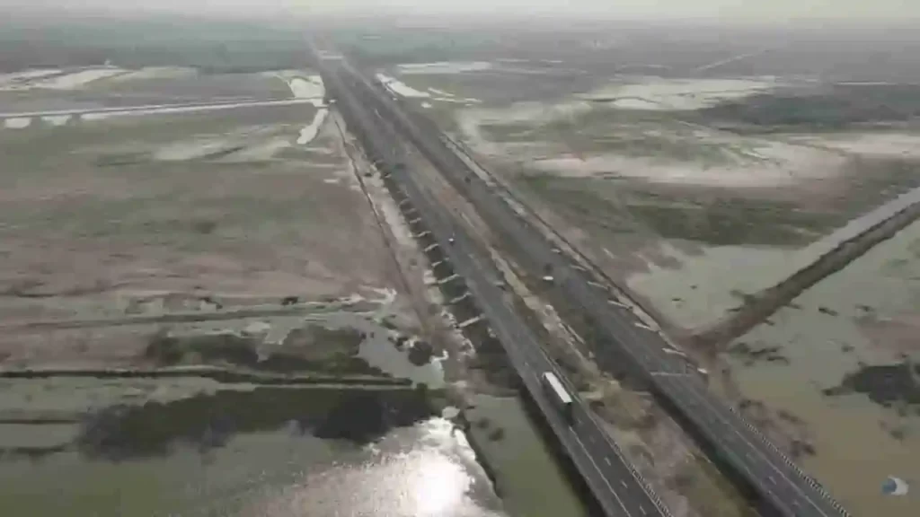
Imagine zipping from the bustling heart of Ahmedabad to the rising star of Dholera in just 45 minutes, instead of a bumpy two-hour crawl. That dream roared to life on Tuesday when Prime Minister Narendra Modi cut the ribbon on the stunning Ahmedabad-Dholera Expressway, a sleek, Rs 5,100 crore marvel of engineering that’s set to supercharge Gujarat’s economy.These developments focus on roads, railways, semiconductors, renewable energy, and urban mobility.Ahmedabad-Dholera Expressway Now OpenPM Modi inaugurated the Ahmedabad-Dholera Expressway on March 31.Cost: Over Rs 5,100 crore.Type: Access-controlled highway.Length: Approximately 110 km.Travel time: Reduces from 2 hours to 45 minutes.Speed limit: Up to 120 kmph.Benefits: Improves connectivity to Dholera Special Investment Region (DSIR), boosts industrial growth, and supports economic development.Road and Highway ProjectsThe Prime Minister laid foundation stones for key road upgrades:Four-lane Idar-Badoli bypass with paved shoulders.Upgrade of Dholavira–Mauvana–Vauva–Santalpur section (Package II) of National Highway 754K to a two-lane with paved shoulders.These projects aim to reduce travel time, enhance safety, and support logistics.Flyovers for Urban Traffic ReliefTwo flyovers were addressed to ease congestion in Gandhinagar and Ahmedabad:Inaugurated: Flyover at PDPU Junction on Gandhinagar-Koba-Ahmedabad Airport Road (handles over 1.4 lakh vehicles daily).Foundation laid: Flyover at Bhaijipura Junction on Gandhinagar-Koba-Airport Road (includes parking facilities below).These will cut commute times to the airport and state capital.Keynes Semicon Plant InauguratedPM Modi inaugurated the Keynes Semicon plant in Sanand, Ahmedabad.Milestone: Second semiconductor plant in India to start commercial manufacturing.Initial product: Advanced Intelligent Power Modules (IPMs) with 17 chips each.Applications: Automotive and industrial power systems.Client: Alpha & Omega Semiconductor (California-based).Full capacity: 6.33 million units per day.This strengthens India’s semiconductor sector.Railway Infrastructure UpgradesDedicated to the nation:Kanalus-Jamnagar doubling project (28 km, part of 111.20 km Rajkot-Kanalus project).Quadrupling of the Gandhidham–Adipur section (10.69 km).These improve train frequency and freight movement.Renewable Energy BoostPM Modi inaugurated Khavda Pooling Station-2 and associated transmission systems.Capacity: Evacuates 4.5 GW of renewable energy.Role: Supports Gujarat’s solar and wind power grid.Gujarat now leads India in solar power generation, as highlighted by the PM.PM Modi’s Remarks on Gujarat’s ProgressDuring the public address, PM Modi highlighted Gujarat’s leadership in renewable energy. He recalled establishing a multi-technology solar park in 2010 as Chief Minister, which laid the foundation for the state’s solar growth.Broader ImpactThe projects cover connectivity, industry, green energy, healthcare, and tourism. They align with national goals for infrastructure and sustainable development. Official sources confirm all details from the Prime Minister’s Office and the Gujarat government announcements.
Noida International Airport (Jewar Airport) Inauguration: A Transformational Push to India’s Aviation and Regional Growth
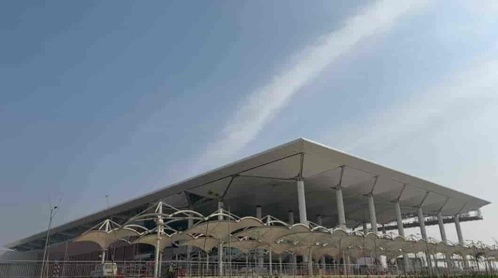
The inauguration of the Noida International Airport, widely known as Jewar Airport, marked a landmark moment in India’s aviation and infrastructure expansion. Positioned as one of the country’s largest and most ambitious greenfield airport projects, its launch has been seen as a strategic move to decongest existing aviation hubs and unlock new economic potential across northern India.Located in Jewar in Uttar Pradesh’s Gautam Buddha Nagar district, the airport has been developed to serve the rapidly growing travel demand of the National Capital Region (NCR), while also acting as a catalyst for industrial, logistical, and urban development in surrounding areas.Why India Needed a Second Major Airport in NCRFor years, the Indira Gandhi International Airport in Delhi has handled the bulk of air traffic in northern India. With passenger numbers steadily rising, the airport has been operating close to its maximum capacity, leading to congestion, delays, and operational strain.The idea of developing a second airport in the NCR was not just about expansion, but about redistributing aviation load and future-proofing infrastructure. The Noida International Airport was conceptualised to address these issues while supporting the long-term growth of one of India’s busiest urban corridors.Its location near the Yamuna Expressway provides strategic access not only to Delhi but also to key cities like Noida, Greater Noida, Ghaziabad, Agra, Mathura, and Aligarh. This makes it a regional hub rather than just an alternative airport.Scale, Design and Multi-Phase DevelopmentWhat sets the Noida International Airport apart is its scale and long-term vision. Unlike many existing airports that evolved through gradual expansion, this project has been planned from the outset as a multi-phase mega infrastructure development.In its first phase, the airport has been designed to handle around 12 million passengers annually, with a single runway and terminal. However, the long-term plan is far more ambitious. Once fully developed, the airport is expected to:Handle over 70 million passengers per yearOperate multiple runwaysInclude expansive cargo terminals and logistics parksSupport maintenance, repair, and overhaul (MRO) operationsThis phased approach ensures that the airport can scale alongside demand, making it a future-ready aviation hub.Focus on Sustainability and Modern InfrastructureOne of the defining aspects of the project is its emphasis on sustainability. The airport has been planned as an environmentally responsible infrastructure project, incorporating:Energy-efficient terminal designsWater conservation systemsReduced carbon footprint strategiesSustainable construction practicesGlobally, there has been increasing focus on green aviation infrastructure, and the Noida International Airport aligns with this shift by aiming to become one of the more eco-conscious airports in the region.Connectivity and Integration with Transport NetworksA major strength of the Jewar airport lies in its planned connectivity. The project is not being developed in isolation but as part of a larger, integrated transport ecosystem.The airport is expected to be connected through:The Yamuna Expressway and Eastern Peripheral ExpresswayProposed metro rail extensionsRegional Rapid Transit Systems (RRTS)High-speed rail links in the futureThis multi-modal integration will ensure seamless movement of passengers and goods, significantly reducing travel time and improving accessibility across the NCR and beyond.Economic Impact: A New Growth Engine for Uttar PradeshThe inauguration of the airport is expected to trigger a wave of economic activity in the region. Large infrastructure projects often act as growth multipliers, and Jewar is already witnessing rapid transformation.The airport is likely to:Generate thousands of direct and indirect employment opportunitiesBoost real estate demand in nearby areasAttract domestic and international investmentPromote development of logistics and warehousing hubsPlans for an aerotropolis—a city built around the airport—are also underway, which could include business districts, commercial centres, hotels, and industrial zones.This development is expected to strengthen Uttar Pradesh’s position as a major economic and industrial hub in northern India.Boost to Trade, Cargo and LogisticsBeyond passenger travel, the airport is expected to play a crucial role in cargo and logistics operations. With increasing demand for faster supply chains and export-oriented industries, the need for efficient cargo infrastructure has grown significantly.The Noida International Airport is being developed with dedicated cargo facilities, which will:Facilitate faster movement of goodsSupport export industries in the regionImprove connectivity for perishable and high-value goodsIts proximity to industrial clusters makes it particularly well-suited to serve as a logistics hub.Impact on Travel and Passenger ExperienceFor travellers, the airport is expected to bring noticeable improvements in convenience and efficiency. With reduced pressure on Delhi’s main airport, passengers can expect:Shorter wait timesBetter flight availabilityImproved travel experienceResidents of Noida, Greater Noida, and nearby regions will especially benefit, as they will no longer need to rely solely on Delhi for international travel.A Shift Towards Decentralised Urban DevelopmentThe development of the Jewar airport reflects a broader shift in India’s urban planning strategy—moving away from over-centralisation towards distributed growth models.By creating infrastructure hubs outside major metropolitan centres, the government aims to:Reduce pressure on existing citiesEncourage balanced regional developmentImprove quality of life in emerging urban zonesThe airport is expected to play a key role in shaping the future growth of the NCR, particularly in the Noida-Greater Noida belt.A Defining Moment in India’s Infrastructure StoryThe inauguration of the Noida International Airport is not just about adding another airport to the country’s aviation network. It represents a long-term vision for connectivity, economic expansion, and urban transformation.As air travel continues to grow in India, projects like Jewar airport will play a crucial role in ensuring that infrastructure keeps pace with demand. With its scale, strategic location, and integrated planning, the airport is poised to become one of the most important aviation hubs in the country in the coming years.In many ways, it signals how India is preparing for the next phase of growth—by investing in infrastructure that is not only large in scale but also forward-looking in design and impact.
Kumar Bhaskar Varma Bridge Over Brahmaputra River: Strengthening Connectivity in Assam
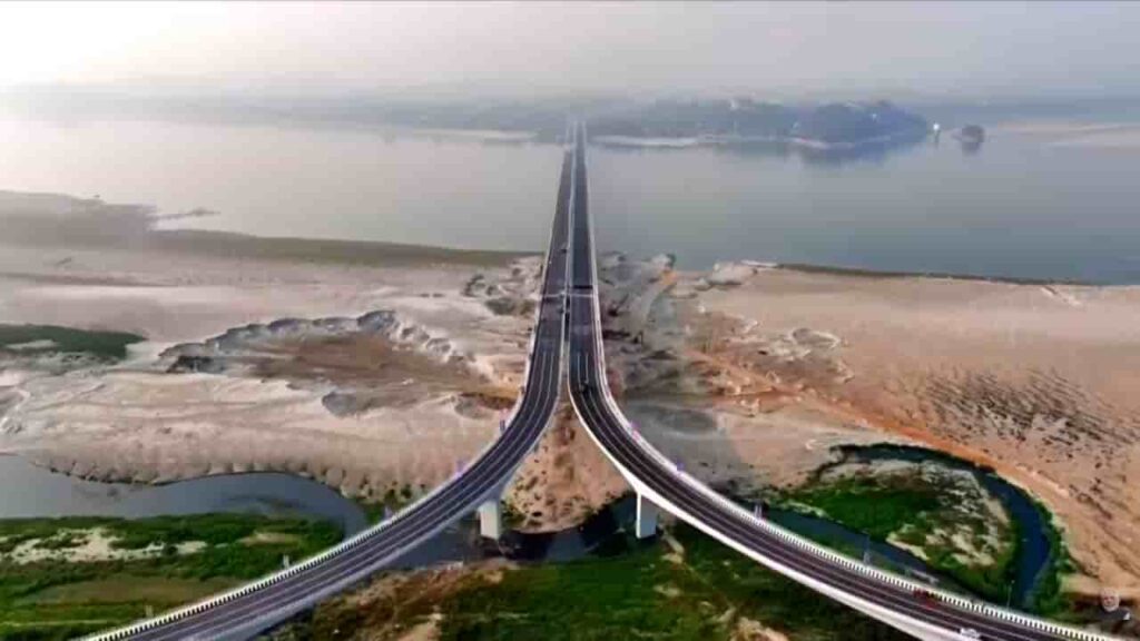
The construction and development of the Kumar Bhaskar Varma Bridge over the Brahmaputra River marks a significant step in enhancing connectivity across Assam. Named after the ancient ruler Kumar Bhaskar Varma, the bridge stands as both an infrastructure milestone and a tribute to the region’s historical legacy.Strategically located, the bridge connects the north and south banks of the Brahmaputra, addressing long-standing challenges of transportation in one of India’s most geographically complex regions.Strategic Location and ImportanceThe Kumar Bhaskar Varma Bridge is being developed near Tezpur, a crucial urban centre in Assam. The Brahmaputra, known for its vast width and unpredictable flow, has historically posed a barrier to seamless connectivity between regions on either side.By linking key districts across the river, the bridge is expected to significantly reduce travel time and improve accessibility for both passengers and goods transport. It will serve as an important alternative route to existing crossings, easing pressure on older bridges and ferry services.Enhancing Regional ConnectivityConnectivity has long been a challenge in Assam, particularly in areas separated by the Brahmaputra. The new bridge aims to transform this by providing:Faster inter-district travelImproved access to healthcare and education facilitiesBetter connectivity for rural and semi-urban areasStrengthened road networks linking national highwaysThe bridge will play a vital role in integrating remote regions with major economic centres, thereby supporting inclusive development.Boost to Trade and Economic ActivityThe project is expected to have a strong economic impact on the region. Assam’s economy relies heavily on agriculture, tea production, and small-scale industries, all of which depend on efficient transportation.With improved connectivity:Movement of goods will become faster and more cost-effectiveTrade between northern and southern Assam will increaseLocal businesses will gain better access to marketsTourism in nearby regions will receive a boostThe bridge is also likely to support cross-border trade routes in the broader Northeast region.Engineering and Infrastructure SignificanceConstructing a bridge over the Brahmaputra is a complex engineering challenge due to the river’s strong currents, shifting channels, and seasonal flooding. The Kumar Bhaskar Varma Bridge reflects advancements in modern engineering techniques designed to withstand such conditions.The structure is expected to feature:Multiple spans to accommodate the river’s widthHigh load-bearing capacity for heavy vehiclesDurable materials suited for flood-prone conditionsSafety features for all-weather usageSuch infrastructure is crucial for ensuring year-round connectivity in a region often affected by monsoon disruptions.Social and Developmental ImpactBeyond economic benefits, the bridge will have a meaningful social impact. Improved connectivity often translates into better quality of life for local communities.Residents will experience:Easier access to hospitals and emergency servicesGreater educational opportunitiesEnhanced mobility for daily commutingReduced isolation of remote areasFor many communities, the bridge represents not just infrastructure, but improved access to essential services and opportunities.Cultural and Historical SignificanceNaming the bridge after Kumar Bhaskar Varma adds a cultural dimension to the project. He was a prominent ruler of the ancient Kamarupa kingdom and is remembered for his contributions to the region’s history.The naming reflects an effort to connect modern development with historical identity, preserving regional pride while moving forward with infrastructure growth.Toward a More Connected NortheastThe Kumar Bhaskar Varma Bridge is part of a broader push by the government to improve infrastructure across Northeast India. Enhanced connectivity is seen as a key driver for economic growth, national integration, and strategic development in the region.As Assam continues to expand its transport network, projects like this bridge are expected to play a central role in shaping the state’s future—bringing regions closer, improving mobility, and unlocking new opportunities across sectors.
NGT Greenlights Great Nicobar Mega-Project: Strategic Lifeline or Ecological Gamble?
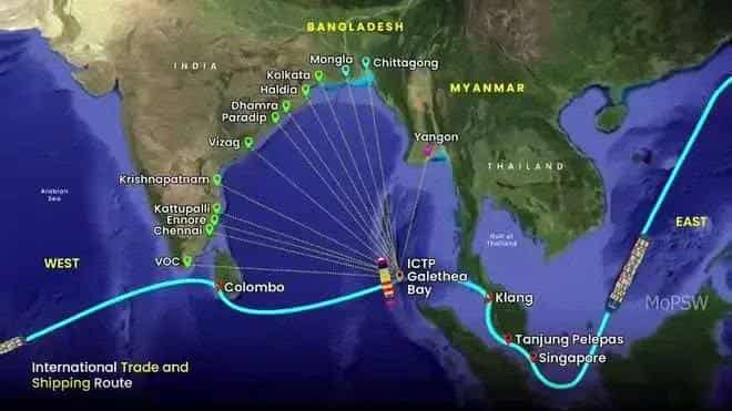
In a landmark ruling, the National Green Tribunal (NGT) on February 16, 2026, upheld environmental clearances for the ₹81,000-92,000 crore Great Nicobar Island development, dismissing petitions citing “strategic importance” and “adequate safeguards,” paving the way for India’s ambitious Bay of Bengal hub amid fierce eco-debates.Project Blueprint: Four Pillars of TransformationSpanning 166 sq km on the 910 sq km island (India’s southernmost at Indira Point), led by Andaman and Nicobar Islands Integrated Development Corp Ltd (ANIIDCO) and NITI Aayog:Dual-Use Airport: Greenfield civil-military strip east of Galathea Bay (4.2 sq km, displacing 379 families); runway north-south over the sea for surveillance near the Six Degree Channel, cutting Port Blair response time by 500+ km; eyes Singapore/Vietnam routes.Transshipment Port: Galathea Bay ICTP challenges Colombo’s monopoly; Leatherback turtle nesting site concerns flagged.Integrated Township: Residential/commercial/tourism/logistics/defense zones; power plant (450 MVA gas-solar).Population Boom: From 6,500 to 3.25L by 2040, 13-15L by 2075, 1L+ jobs projected.NGT bench (Justice Prakash Shrivastava) relied on HPC (ex-secy Leena Nandan) findings: No ICRZ violations, strict compliance mandated.Strategic Imperative in Indo-Pacific Chessboard9km from Sumatra, hugging Malacca Strait trade lanes (80% of India’s oil), Great Nicobar bolsters QUAD/Andaman chain vs. China’s String of Pearls. Dual-use airport enables fighter ops, quick IOR response; port slashes foreign transshipment reliance (₹50,000 cr savings/yr est.). Eco-tourism/scientific hubs eyed, with DPR noting minimal low-alt hill flights.Key Directives on Construction & CoastlineNo Erosion or Shoreline Changes: All activities, including foreshore development, must prevent erosion or adverse coastal alterations across project areas and nearby islands.Preserve Sandy Beaches: Absolute protection for turtle/bird nesting sites, no loss permitted, recognizing their role as natural barriers.Wildlife & Species ProtectionEnvironmental clearance conditions explicitly shield:Leatherback sea turtles (Galathea Bay nesting).Nicobar megapode, saltwater crocodiles, robber crabs, Nicobar macaques, and endemic birds.Long-term monitoring is required for forests, coral reefs, and water quality.Compliance & Tribal MeasuresBinding EC Conditions: Government must enforce all original safeguards without violation at any stage, HPC verified adequacy.Tribal Safeguards: Resettlement honoring pre-tsunami patterns; restricted construction access; include Tribal Councils (Great/Little Nicobar) per Forest Rights Act 2006.Ongoing OversightIndependent ecological audits are mandated.Violations trigger penalties/remediation.NGT emphasized these as non-negotiable for the ₹81,000 cr airport/port/township push on 130 sq km forest land.Ecological & Social StormForest/Wildlife Hit: 130 sq km diversion (14% island), ~1M trees felled; Great Nicobar Biosphere Reserve impacts, Shompen/Nicobarese tribes (84 sq km land) at risk.Critics Cry Foul: Petitions highlighted turtle bays, river deltas; NGT deems safeguards (e.g., no CRZ breaches) sufficient.Population Pressure: 6.5L by 2050 strains fragile marine/forest ecosystems.ANIIDCO insists on mitigation: Site grading, sea-path flights. NGT: “Strategic needs outweigh; monitor compliance.NGT safeguards for the Great Nicobar project aim to protect the vulnerable Shompen tribe—a Particularly Vulnerable Tribal Group (PVTG) of ~200 semi-nomadic hunter-gatherers—primarily by enforcing spatial, surveillance, and legal isolation from project activities, though critics argue enforcement gaps persist.Core Spatial & Access ProtectionsNo Habitat Disturbance: Project explicitly bans encroachment into Shompen settlements, core zones (Galathea/Alexandrina Rivers), or traditional foraging areas—130 sq km forest diversion excludes their 84 sq km reserve.greentribunal+1Geo-Fencing & Surveillance: Towers and restricted entry zones encircle tribal habitats to prevent outsider contact, minimizing disease transmission risks (past epidemics decimated PVTGs like Jarawas).Oversight & Welfare MandatesDepartment of Tribal Welfare (DTW) Lead: Monitors safety, provisions (non-invasive food at Campbell Bay hospital), and rights under Andaman & Nicobar (Protection of Aboriginal Tribes) Regulation 1956, no exploitation of reserve resources by non-tribals.NCST Consultation: Article 338A(9) compliance verified; Forest Rights Act 2006 gram sabha inclusion for PVTGs, though implementation historically lags (“Nil” FRA progress reported).Isolation Protocols: No permanent non-tribal/Govt residences in reserve; temporary camps only for welfare/research; cross-infection barriers in healthcare.Legal & Compliance BackboneNGT/HPC upheld 2022 EC conditions as “adequate”: Independent audits, penalties for violations, tribal council involvement (Great/Little Nicobar). Pre-tsunami resettlement patterns honored; Shompen rights (hunting under Wildlife Act amendment) preserved.Lingering ConcernsAnthropologists warn of indirect threats (fragmented forests, population influx to 3L+ by 2040, disrupting semi-nomadic life); NGT mandates monitoring but lacks PVTG-specific veto power, compliance now pivotal for ~181 Shompen across 56 households.Path ForwardClears legal logjam post-2022 EC; HPC revisited 2023 concerns. Investments (₹1L cr+) promise jobs/hotels but hinge on tribal consent, monitoring.As “India’s Hong Kong,” Great Nicobar eyes global tourism map, balancing security surge with island fragility.
Mumbai Hits Play: India’s First Musical Road Belts Out ‘Jai Ho’ – Your Drive Just Got an Oscar-Worthy Soundtrack!
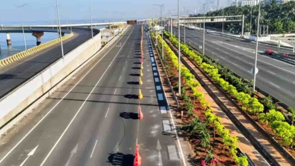
Picture this: You’re cruising out of Mumbai’s swanky Coastal Road tunnel, windows up, AC humming, when suddenly… thrum-thrum-TA-DA! A.R. Rahman’s Oscar-winning Jai Ho explodes from your tires. No speakers, no playlist – just pure road magic! On February 11, 2026, the Brihanmumbai Municipal Corporation (BMC) flipped the switch on India’s first musical road, a 500-meter groove-fest on the northbound stretch from Nariman Point to Worli. Maharashtra CM Devendra Fadnavis and Deputy CM Eknath Shinde cut the ribbon, but let’s be real – the real stars are the rumble strips stealing the show. A ₹7.5 crore stretch of asphalt grooves that’s got drivers ditching Spotify for tire-tarmac tunes. Is it gimmick, genius, or both? Let’s dive deep into the beats, tech, trivia, and tips that make this road India’s freshest jam.How This Asphalt Symphony Works Forget pothole symphonies of despair. This ₹7.5 crore wonder uses Hungarian-engineered rumble strips, think tiny grooves laser-cut into the asphalt at ninja-level precision. Hit 60-80 kmph (that’s your sweet spot, speed demons), and your tires “strum” the road like guitar strings. Vibrations bounce inside your car (hello, natural resonator!), birthing Jai Ho’s triumphant beats. Too slow? Silence. Too fast? Chaos. Just right? You’re Slumdog Millionaire’s dancing hero.Signboards scream warnings 500m, 100m, and 60m ahead (even in the tunnel): “Slow to 70-80 kmph for Jai Ho!” – BMC’s sneaky genius for safer speeds. Pro tip: Early mornings or late evenings = lighter traffic, clearer tunes. Windows up? Still slaps.Not Just Gimmick – A Global Groove GangMumbai joins an elite club: Japan kicked it off in 2007 (Asphaltophone vibes from Denmark’s 1990s artists), with Hungary, South Korea, UAE, USA, China, and more grooving along. Mumbai’s twist? Oscar swagger via Rahman. “It’s engineering meets entertainment,” BMC boasts, and honestly, who wouldn’t merge lanes for melody?Why You’ll Ditch Spotify for This StretchBucket-List Drive: Northbound only, post-tunnel joyride – perfect Instagram reel fodder (tag your co-pilot’s jaw-drop).Safety Sneak: Tunes tempt ideal speeds, cutting rash-driving blues.Mumbai Flex: Coastal Road’s tunnel-to-sea views + free concert? Peak city swagger.Fun fact: Sound stays inside your vehicle – no blaring for neighbors. Celebs, your move – Virat, Deepika, ready for a Jai Ho cruise?Next time you’re Mumbai-bound, skip the aux cord. Let the road sing. Jai Ho indeed – India’s drive game just leveled up! The Magic Under the Tires: How Rumble Strips Remix RahmanNo speakers, no speakers, just pure physics playing DJ. Picture rumble strips on steroids: Precisely engineered grooves (depths and spacings calculated to millimeter perfection) etched into the asphalt divider-adjacent lane. Cruise at the “Goldilocks speed” of 60-80 kmph (BMC’s sweet spot: 70kmph for crystal-clear Jai Ho), and your tires “strum” the ridges like a sitar. Friction sparks vibrations that resonate through your chassis, your car becomes a natural echo chamber, birthing sound waves tuned to Rahman’s triumphant melody.Science Breakdown: Narrower grooves = higher pitches (that TA-DA! hook); wider ones rumble low bass. Speed too low? Muted hum. Zoom past 80? Cacophony. Windows up? Still slaps – sound’s trapped inside for your private gig.Safety Symphony: BMC’s ulterior motive? Nudge safe speeds on the high-speed Coastal Road. Signage screams from 500m, 100m, and 60m ahead (tunnel inklings too): “Maintain 70-80 kmph for Jai Ho!” It’s behavioral engineering disguised as fun – fewer accidents, one catchy chorus at a time.Cost & Specs: ₹7.5 crore for 500m of melodic mastery. Northbound only (Breach Candy exit vibes), audible solely in-vehicle, no neighborhood noise wars.Early birds report goosebumps: “Felt like Rahman remixed my engine!” quips a tester. Rainy days? Tunes hold (grooves drain fast). Pro drive hack: Early mornings/late evenings = traffic-light serenades.Mumbai Joins the Global Groove Parade: Musical Roads Around the WorldIndia’s debut steals from a quirky international playlist. Japan pioneered in 2007 (Honda’s Fukuoka “Melody Road” played anime OSTs), sparking a wave:Hungary: Tech blueprint here – traffic-calming tunes (Mumbai adapted theirs).South Korea/UAE: K-pop/Arabic hits for highways.USA/China/Iran/Russia/Turkey: From California’s “Honda Sounds” to Tehran’s Persian pops.Roots trace to Denmark’s 1990s Asphaltophone, artists Steen Krarup Jensen and Jakob Freud-Magnus vibing pavement poetry. Mumbai elevates: Jai Ho’s global Oscar cred (2009 Best Original Song) nods Bollywood’s soft power. Fun global nugget: Japan’s roads “sing” only at exact speeds, stray, and it’s static city!Why Mumbai? Coastal Road’s Perfect StageThis isn’t random tarmac, it’s the poster child for BMC’s infrastructure glow-up. The Coastal Road (Nariman Point-Worli sea-link shortcut) slashes commute hell, dodging Marine Drive snarls. Post-tunnel emergence? Epic: Arabian Sea sunsets + surprise soundtrack = Insta-gold. BMC’s vision: Blend utility (speed enforcement) with wow-factor (tourist trap). Travel buffs: Hit lighter hours – dawn cruises amplify sea breeze + Jai Ho euphoria.Beyond the Buzz: Real Impact and Reader RoadmapCeleb Bait?: Expect Bollywood cameos, Coastal Road’s elite lane screams influencer flex.Eco Angle: Grooves sip minimal asphalt; no lights/power draw.Expansion Tease: BMC eyes more stretches – patriotic anthems next?Your Play-by-Play Guide:Enter Northbound: Nariman Point → Worli tunnel.Spot Signs: Gear down to 60-80 kmph.Exit Tunnel: Jai Ho drops – film it (safely!).Best Time: 6-9 AM/7-10 PM – queue-free vibes.Pit Stops: Worli Sea Face for post-tune selfies.Critics yawn “gimmick,” but riders rave: “Engineering poetry!” In a pothole-plagued nation, Mumbai’s dropping beats, not bombs. Next time you’re Mumbai-bound, skip the aux cord. Let the road sing. Jai Ho indeed – India’s drive game just leveled up!
Government Announces 7 New Bullet Train Corridors in India: A Transformative Push for High-Speed Connectivity
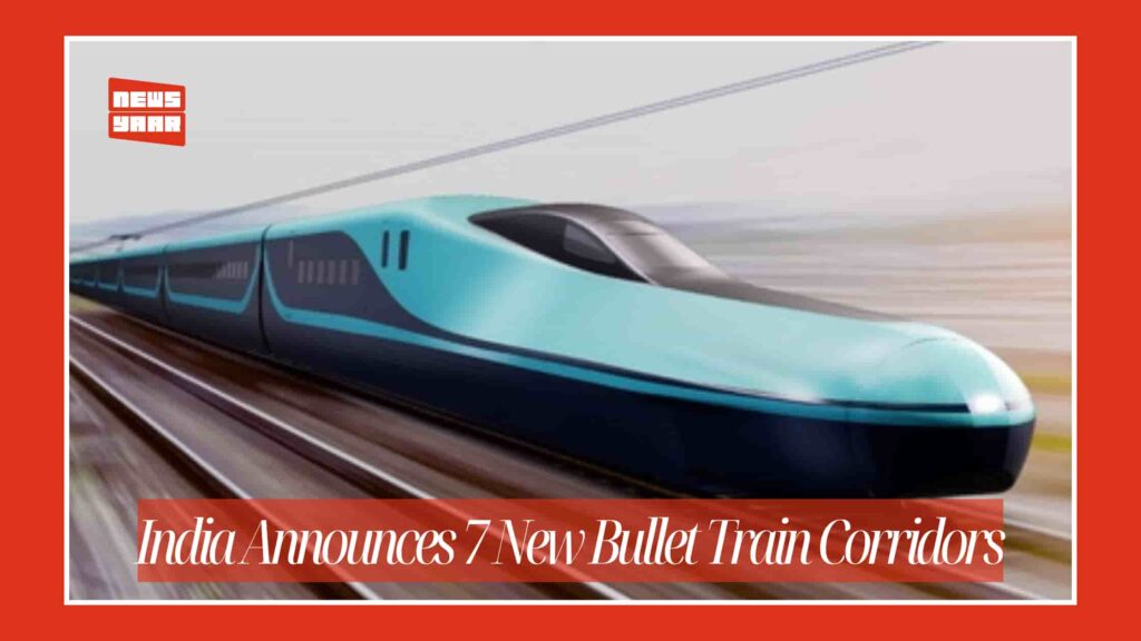
In a landmark expansion of India’s rail infrastructure, the Government of India has announced the development of seven new high-speed rail corridors — popularly referred to as bullet train routes — as part of the Union Budget 2026–27. The ambitious initiative aims to transform inter-city travel by significantly reducing travel times, boosting economic growth and enhancing connectivity between major urban and economic hubs across the country.Announcement and Policy ContextUnion Finance Minister Nirmala Sitharaman unveiled the corridors during her Budget 2026–27 speech in Parliament, categorising them as “growth connectors” that will promote environmentally sustainable passenger transport systems across India’s rail network. These high-speed corridors complement the Mumbai–Ahmedabad High-Speed Rail Corridor (MAHSR) — India’s first bullet train project — and build on the government’s broader infrastructure and mobility agenda.Railway Minister Ashwini Vaishnaw has confirmed that detailed preparations are underway, with Detailed Project Reports (DPRs) being finalized and pre-construction activities initiated through the National High Speed Rail Corporation Limited (NHSRCL). The government is focused on fast-tracking implementation and standardising high-speed rail system development nationwide.Proposed Bullet Train Corridors: Routes and ConnectivityThe announcement includes seven high-speed rail corridors that will link key cities and regions across India. These corridors are expected to span nearly 4,000 km and strategically connect major economic, industrial and cultural centres. The routes identified are:Mumbai–Pune High-Speed Rail Corridor — strengthening connectivity within Maharashtra’s economic belt.Pune–Hyderabad High-Speed Rail Corridor — linking western and southern economic hubs.Hyderabad–Bengaluru High-Speed Rail Corridor — a major southern technology and industry link.Hyderabad–Chennai High-Speed Rail Corridor — connecting southern metros with coastal economic zones.Chennai–Bengaluru High-Speed Rail Corridor — improving travel between two major southern cities.Delhi–Varanasi High-Speed Rail Corridor — enhancing northern connectivity with Uttar Pradesh’s cultural capital.Varanasi–Siliguri High-Speed Rail Corridor — extending high-speed reach toward eastern India and gateway regions.Collectively, these corridors aim to connect financial hubs, technology clusters, manufacturing centres and emerging cities with modern high-speed rail infrastructure.Strategic Goals and Economic RationaleGovernment officials have described the new corridors as not just transport projects but growth engines that will:Reduce travel times drastically between key city pairs (for example, a bullet train between Mumbai and Pune could reduce travel to under an hour), enhancing convenience and productivity.Stimulate regional economic development by creating linked urban-industrial corridors that attract investment, tourism and job creation.Support environmental sustainability by offering cleaner and more energy-efficient alternatives to road and air travel.Drive technology and manufacturing growth by enabling high-speed rail ecosystem development, including engineering, signalling, rolling stock and systems integration.Union Minister Ashwini Vaishnaw has emphasised that the initiative will contribute toward India becoming 100 per cent self-reliant (Atmanirbhar) in high-speed rail technologies, with a focus on leveraging indigenous manufacturing and innovation wherever feasible.Implementation and TimelineWhile the Mumbai–Ahmedabad corridor is already under construction and expected to begin phased operations starting 2027 for the Surat–Bilimora section and full completion by 2029, the new seven corridors are in the pre-construction and planning stage.Officials have indicated that preparation of DPRs, alignment finalisation, land acquisition and contract documentation will be prioritised over the coming months, with work expected to begin once these foundational studies are complete. Dedicated field teams for each corridor will support expedited project execution.Broader Impact on Indian Railways and MobilityThe seven new bullet train corridors represent a shift toward world-class rail mobility in India, aligning with global best practices in high-speed transportation. Once operational, these corridors are expected to:Enhance national connectivity across key economic belts in the west, south, north and east.Reduce congestion on existing air and road networks by providing faster, reliable alternatives.Boost tourism by enabling easy access to major cultural and heritage destinations.Encourage urban transformation through transit-oriented development along high-speed rail alignments.Looking Ahead: A New Era of Rail TravelThe announcement of seven additional bullet train corridors marks a transformational phase for Indian Railways, moving the nation closer to a widespread high-speed rail network that complements existing infrastructure and accelerates economic integration. By linking metropolitan centres and regional hubs with modern, efficient rail travel, the government aims to redefine mobility in India and position the country as a global leader in high-speed rail development.Summary of the New Bullet Train CorridorsRouteRegionStrategic RoleMumbai–PuneWestEconomic mobility in MaharashtraPune–HyderabadWest–SouthIndustrial and technology linkageHyderabad–BengaluruSouthConnects major IT & innovation hubsHyderabad–ChennaiSouthCoastal economic corridorChennai–BengaluruSouthSouthern metro connectivityDelhi–VaranasiNorthLinks capital with cultural heartlandVaranasi–SiliguriNorth–EastGateway to eastern region
Report says, India beats Japan to become world’s 4th largest economy
In a milestone moment for the Indian economy, official data and projections indicate that India has surpassed Japan to become the world’s fourth-largest economy, a result of strong growth momentum, robust domestic demand, and strategic economic reforms. With a nominal Gross Domestic Product (GDP) estimated at around USD 4.18 trillion in 2025, India is now ranked fourth globally, trailing only the United States, China, and Germany in size.The shift in rankings reflects decades of economic transformation driven by liberalisation, digital and manufacturing reforms, and one of the world’s most dynamic young labour forces. India’s rise in the global economic order has been steady, moving from the eleventh largest economy in 1990 to the fifth in recent years, ahead of major developed countries such as the United Kingdom before overtaking Japan.According to government releases and international forecasts, the Indian economy’s recent performance has been marked by accelerating GDP growth. Official figures show that India’s real GDP expanded by 8.2 per cent in the second quarter of the 2025–26 fiscal year, up from 7.8 per cent in the previous quarter and 7.4 per cent in the final quarter of 2024–25, led by resilient domestic consumption and expanding services and industrial activity.The government’s year-end economic review highlighted that with a GDP valued at USD 4.18 trillion, India has overtaken Japan and is poised to move into the third spot globally in the next 2.5 to 3 years if current growth continues. Projections suggest India’s GDP could reach as high as USD 7.3 trillion by 2030, potentially placing it above Germany and reinforcing its position as a dominant economic power.India’s ascent has drawn wide attention from business leaders and economists. Industry figures such as Anand Mahindra noted that overtaking Japan, long considered an economic powerhouse, is “no small achievement,” underlining the country’s rapid rise driven by entrepreneurial energy and large-scale reforms. He also stressed that while the milestone is significant, continued focus on per capita income and inclusive development will be critical for sustained progress.The achievement also reflects broader global economic shifts. Japan’s economy has faced challenges from demographic decline and slower growth rates, while India’s younger population, expanding middle class, and increasing integration into global trade and technology supply chains have helped boost its economic trajectory. International agencies, including the International Monetary Fund (IMF), World Bank, and rating agencies like Moody’s and Fitch, have projected continued GDP growth for India over the next several years.Despite this success, some analysts caution that headline GDP figures do not fully capture underlying economic welfare, such as per capita income, where India still lags significantly behind Japan. They argue that while India’s total economic output now ranks fourth, focus on quality of growth, productivity improvements, and equitable income distribution remains essential.For now, India’s leap past Japan into the fourth position underscores a transformative economic journey and a rapidly evolving role in global economic leadership. As India continues to expand its industrial base, innovate in technology and services, and enhance global trade relations, its trajectory toward becoming one of the world’s top three economies appears increasingly plausible.